|
IOWA RENTALS/OUTFITTERS:
Appleby Canoe Rental, Maquoketa River, 21430 River Road, Monticello (319 465-369)
Ames Outdoor Gear, 4723 Lincoln Way, Ames (515-292-2276)
Bickford Canoe Rental, Maquoketa River at Monmouth (563-652-5855)
River & Trail Outfitters, Inc. 212 Pulpit Rock Road, Decorah (563-382-6552)
CanoeSport Outfitters, Lake Aquabi and Indianola (1-800-257-6080)
Chimney Rock Canoe Rental & Campground, Upper Iowa River near Bluffton (563-735-5786)
Circle C Campground, Iowa River near Alden (641-648-9936)
Garst Farm Resort, Middle Raccoon River at Coon Rapids
Harvest Farm Camground, Upper Iowa River at Harmony, MN (563-883-8562)
Hruska's Canoe Livery, Upper Iowa at KendallVille (563-547-4566)
Iowa Falls Outfitters, Iowa River/Hardin County (641-373-6302)
ISU Recreation Services, Ames (students and staff only)
Johnson Canoe Rental, 2643 West Ravine Road, Decorah, IA 52101
Lynn County Parks, on the Wapsipinicon at Pinicon Ridge Park
Linn Grove Landing, Little Sioux at Linn Grove (712-296-3635)
Osterdock Outfitters, Turkey River near Osterdock (563-252-9050)
Raccoon River Excursions, Booneville (515-689-4207)
Randy's Bluffton Store, Upper Iowa River at Bluffton (563-735-5738)
River Basin Canoe & Kayak, Skunk, Iowa, Des Moines, and the Mississippi near Burlington (800-748-3712)
River Ranch Campground, Little Cedar at Nashua (641-435-2108)
River's Access LLC, Middle Raccoon at Redfield (515-971-8820)
Riverside Canoe Rentals, Iowa River at Riverside (319-648-2103)
RiverView Canoes & Campground, Des Moines River at Farmington (319-878-3715)
Rock-n-Row-Adventures, Iowa River Tube Rides, near Steamboat Rock
Scenic Ridge View Exotic Animal Ranch Campground, Yellow River near Marquette (563-586-2721)
Seven Oaks Scenic River Floats, Boone (515-432-9457)
Skip-A-Way Resort, Turkey River at Clermont (563-423-7338)
Turkey River Canoe Trips, 117 South Main, Elkader, IA 52043 (1-800-250-2466) Clayton County
Twin Lakes Bait Shop, Iowa River near Eldora (641-858-2084)
Upper Iowa Canoe Rental, PO Box 301, Decorah, IA 52101
Upper Iowa Resort Rental, Upper Iowa River near Dorchester (563-568-3263)
Walnut Acres, Maquoketa River near Monticello (319-465-4665)
Yellow River Stable Rides, Yellow River near Ion
RIVER ACCESSES:
(Most of these access points are listed in the old Iowa DNR Canoe Guide but their location is difficult to determine from the maps and descriptions)
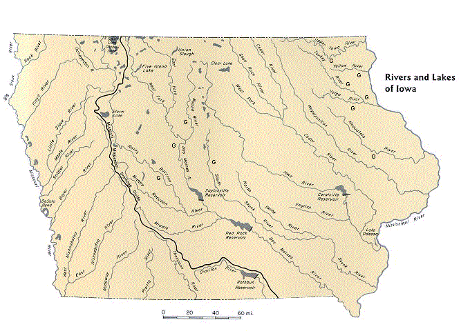
Boone River:
Riverside Park - In Webster City off East 2nd near R33 & on the West side of the river;
Briggs Woods - On Hwy 17 2 miles South of Webster City - follow road through park to landing near 17 bridge;
Albrights - 270th St south of Briggs (access is river-left below the bridge);
Bever Bridge - On 280th St east of D41/17 and west of D46/R27 (take out above the bridge, river-left on Inkpaduta Rd);
Tunnel Mill - Off R27 South of bridge;
Bells Mill - North from D56 between R21 & R27;
Boone Forks - Take D54 North from Stratford, turn North on Shiloh just before D54 crosses the Des Moines River.
Note: The mileage listed between Bever Bridge and Tunnel Mill should be 5.6, not 7.6 (The mileage was not adjusted when Bever Bridge was added to the Canoe Guide). Mileages between Tunnel Mill and Bells Mill, and between Bells Mill and Boone Forks may both be long. Expect these sections to take an hour or less under spring streamflows.
Des Moines River:
Norton's Ford - From E18 bridge, west ~1.5 miles to J Ave, north 1 mile to "T", east on 118th to Juniper Rd, south to undeveloped access. Park on dead-end road.
Fraser ramps - on Juniper Road, south from E18 or north from E26. Both are on the south or west side opposite Fraser. Beware of low-head dam between these ramps!
Waterworks Ramps - Off E26 northwest of Boone. Upstream ramp is north of E26, downstream access is south of E26 at end of road (turn off E26 east of bridge & follow road past wellfields). Beware of low-lead dam between these boat ramps!
Riverbend Ramp - Just north of US Hwy 30 west of river.
See Des Moines River Waypoints for a listing of access points, dams, portages, and bridges with GPS coordinates.
Shell Rock River:
Strand Park - north of Plymouth on S56. Access is east of the bridge.
Skunk River: See SKUNK RIVER WATER TRAIL
Turkey River:
Gilbertson Park - East of Elgin on B64;
Frieden Park - On C1X/Chariot Rd Northwest from downtown Elkader & accross river from
Big Spring Trout Hatchery - off Big Spring Rd 4 miles North of Elkader on X16;
Ten (Seven) mile Bridge - approximately 3 miles upstream from Frieden on Cable Ave;
Motor Mill Access - Take C1X from Hwy 13 on the North edge of Elkader 4 miles to Galaxy Rd, follow Galaxy 3 miles to Motor;
Garber Bridge - South edge of Garber on X41.
See Explore the Turkey River
Volga River:
Klocks Island Park - On Hwy 93 just West of Fayette & Hwy 150;
Langeman's Ford - On Hemlock Road 1 mile north of C24 (Kornhill Road) SE of Fayette;
Volga River State Recreation Area - 2.5 miles north of Hwy 93 on Hwy 150. (Turn at Ivy Road, Access is on road south of campground);
Volga River Access - On Heron Road just south of Ivy Road on the East edge of the Volga River State Recreation Area ("Lima" on DeLorme map);
"Grannis Creek" - State Access Area - On Fox Road between Volga River SRA & Wadena - take Fox Road East from intersection of Heron and Ivy Roads (access to the Volga may be on private property);
Osborne Outdoor Education Center Park - On Hwy 13 five miles southwest of Elkader;
Garber Bridge (Turkey River) - South edge of Garber on X41.
Yellow River:
Volney Bridge - Southwest of Volney on X26 - or use bridge at Big Foot Rd Southeast of Volney;
Sixteen Bridge - on Linton Drive just East of X32 and Old Sixteen Rd - take Bigfoot Rd East to Linton, or Old Sixteen Rd South from Hwy 76 (& just west of B25);
Ion Bridge - On Ion Rd/X36 off Hwy 76 - or use public areas on Old Mission Rd, which follows the river approximately two miles downstream from Ion Bridge;
Hwy 76 Access - Just North of Smokey Hollow Rd and Effigy Mounds;
Yellow River Access - On the Mississippi just south of the 76 bridge.
Note: There is a concrete ford/farm road crossing midway between Sixteen and Ion (near the section line) which should be portaged or scouted. (See Yellow River, April 7th, 2000)
Get your Yellow River Valley Canoe & Heritage Trail brochure from the Allamakee County Economic Development & Tourism Commission, 1-800-824-1424.
If you paddle in NE Iowa, you should pick up a "Fayette, Winneshiek, Allamakee & Clayton Counties, Iowa" map (by Area Map Service, Cincinnati, Ohio) from an area business. This map includes the Upper Iowa, Yellow, Turkey, Little Turkey and Volga Rivers, all secondary roads (named) and crossings. Similar maps are available in Wisconsin.
You may also want the state "Atlas and Gazetteer", available at many sporting goods stores. See DeLorme at Maps
The Iowa Association of County Conservation Boards maaintains a list of CCB addresses, phone numbers, email & websites at
http://george.ecity.net/iaccb/ccbs.html.
Who owns the rivers?
In Iowa we differentiate between "meandered" and "non-meandered" streams, "meandered" in this case being a term used when the state was first surveyed in the mid 1800's.
For those rivers designated as meandered (generally the larger rivers, see list below), the state owns the stream bed up to the normal high water mark. For those designated as non-meandered, the state owns the water only, and the adjacent land owners own the stream bed.
It has often been said that if you step out of your boat on a non-meandered river, technically you are trespassing. This may not be so as it can be considered a part of "navigating" (see below). But it has never been tested in court.
From the Iowa Code 462A.69 Public use of water for navigation purposes:
Water occurring in any river, stream, or creek having definite banks and bed with visible evidence of the flow of water is flowing surface water and is declared to be public waters of the state of Iowa and subject to use by the public for navigation purposes in accordance with law. Land underlying flowing surface water is held subject to a trust for the public use of the water flowing over it. Such use is subject to the same rights, duties, limitations, and regulations as presently apply to meandered streams, or other streams deemed navigable for commercial purposes and to any reasonable use by the owner of the land lying under and next to the flowing surface water.
Iowa further defines "navigable waters" as "all lakes, rivers and streams, which can support a vessel capable of carrying one or more persons during a total of six months period in one out of every ten years". The US Supreme Court has ruled that a stream may be navigable even if it contains some obstructions.
Remember that where a public road crosses a stream the public right-of-way also extends across the stream, and you can use these crossings for access. You may encounter and cross a fence in this right-of-way, but as with those encountered in a stream, do not damage it. The property owner has a right and responsibilty to contain his/her livestock and as responsible and conscientious paddlers we must be respectful of all private property.
There are (portions of) 13 interior rivers classified as meandered:
Cedar, lower 157 miles beginning near Cedar Falls
Des Moines, 278 miles,
mouth to confluence of east & west forks
East Fork DM, mouth to north edge of Algona, 39 miles
West Fork DM, mouth to Emmetsburg, 44 miles
Iowa, lower 123 miles beginning west of Marengo
Maquoketa, lower 26 miles beginning near Maquoketa
Little Maquoketa, lower 2 miles
Nishnabotna, lower 6 miles
Raccoon, mouth to Dallas-Polk County line, 13 miles
Skunk, lower 61 miles (none of the South Skunk)
Turkey River, lower 58 miles beginning near Clermont
Upper Iowa River, lower 6 miles
Wapsipinicon, lower 98 miles beginning near Central City
The Iowa DNR has a new publication, the Land Ownership Guide for Watershed Cleanups, which also provides a good explanation of your rights and responsibilties on Iowa's Waterways.
For more information see Meandered Rivers (from the former IA DNR Environmental Protection Division website),
Recreational Navigation, an opinion from the office of the State Attorney General, and
Who Owns the Rivers, previously on the
Iowa Fishing and Floating Guide.
The Handbook of Iowa Boating Laws and Responsibilities also has a section on the Public Use of Water for Navigation Purposes, as does the LEGISLATIVE GUIDE TO STATE REGULATION OF WATERCRAFT AND WATER NAVIGATION (DEC 2005).
| 


